
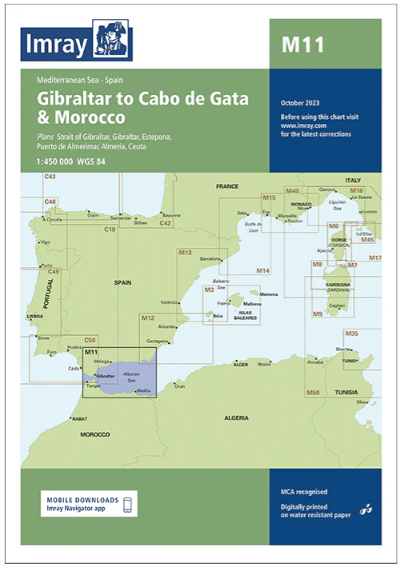
Descripción
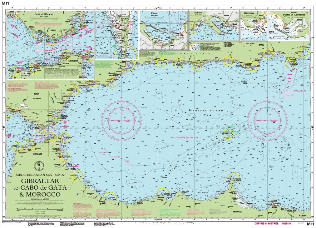
Gibraltar to cabo de Gata and Morocco
Imray
Plans included:
Strait of Gibraltar (1:275 000)
Gibraltar (1:50 000)
Estepona (1:15 000)
Puerto de Almerimar (1:10 000)
Almería (1:25 000)
Ceuta (1:20 000)
This edition includes the latest official UKHO and Instituto Hidrográfico de la Marina Digital, combined with additional information sourced from Imray’s network to make it ideal for small craft.
The chart has been fully revised throughout. The main panel has been rescaled to 1:450 000 for consistency with other M-Series charts in Mediterranean Spain.
The sketch plan of Almerimar has been replaced with a fully georeferenced plan.